How to Use Positive and Negative Numbers to Represent Quantities in the Real-World
Exploring Elevation Above/Below Sea Level is Great Way to Explore Positive and Negative Numbers
Are you looking for a fun way to teach your students about the relationship between positive and negative numbers in a real-world context?
On its own, a mathematical topic such as how positive and negative numbers can be used together to describe opposite directions or values can be confusing and uninteresting to kids who often struggle to see how a topic applies to their world.
Relating mathematics to the real world helps students to understand the practical everyday applications of math, which makes learning math fun, engaging, and, most importantly, meaningful. Plus, understanding the connections between mathematics and real life can spark student interest in math and allow them to see how useful the subject truly is.
In this post, you will learn about a fun activity that explores the relationship between positive and negative numbers in the context of their elevation above or below sea level in comparison to other geographical locations.
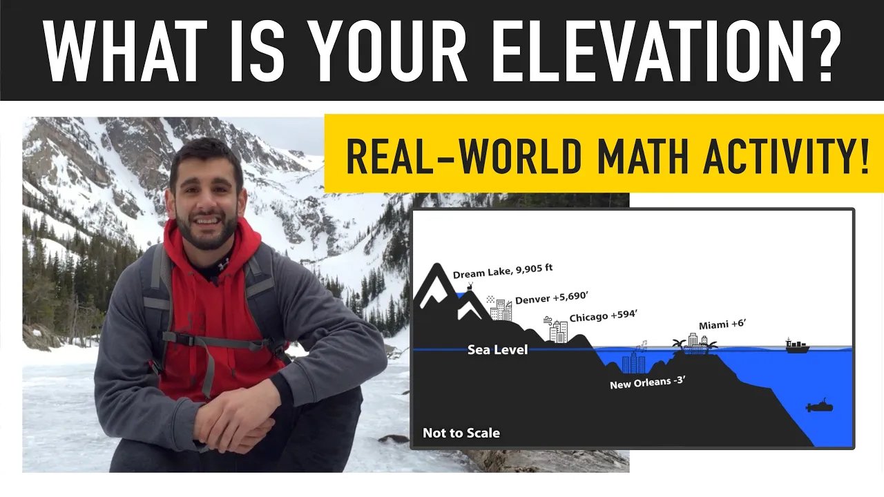
Positive and Negative Numbers Activity: What is My Current Elevation? (Image: Mashup Math FP)
What is My Current Elevation?
Math Activity: What is My Current Elevation Above/Below Sea Level Compared to Other Locations?
Grade Level(s): 5th Grade, 6th Grade, 7th Grade
Learning Standard(s): Understand that positive and negative numbers are used together to describe quantities having opposite directions or values (e.g., temperature above/below zero, elevation above/below sea level, credits/debits, positive/negative electric charge); use positive and negative numbers to represent quantities in real-world contexts, explaining the meaning of 0 in each situation.
This activity helps students understand the concept of elevation, especially in the context of U.S. cities like New Orleans and Miami, which are at or below sea level, and Denver, known for being thousands of feet above sea level.
Click the link below to download the free pdf guide that accompanies this lesson.
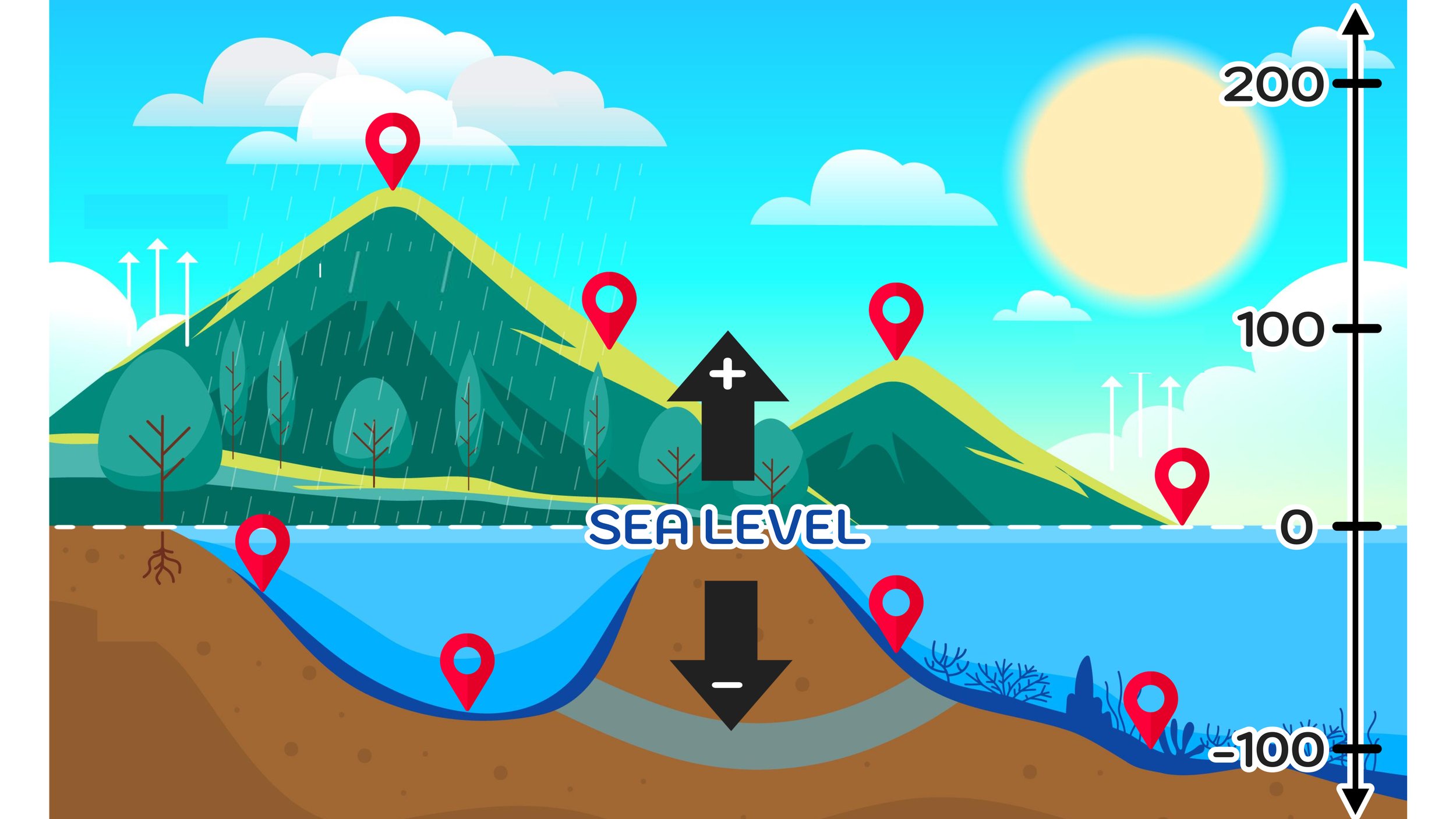
The following activity lets students take a deeper look into finding the elevation of geographic locations with sea level as a reference point. In this case, the measurement tool will be a vertical number line where sea level is at zero. All locations above sea level will have positive elevation values and all locations below sea level will have negative elevation values.
To find the difference in elevation between two locations, students will have to add positive and negative numbers.
For example, to find the difference in elevation between Denver, Colorado (5,690 feet elevation) and New Orleans, Louisiana (-3 feet elevation), students would have to perform the following calculation:

Why is Denver, Colorado called the Mile High City?
Photo by Nils Huenerfuerst on Unsplash

The lesson is interactive and calls on kids to use Google Maps to research their own elevation and figure out how many feet higher or lower they are than my location in Rocky Mountain National Park in Colorado, which is where the video that corresponds with this lesson was filmed!
The lesson also has real world extension questions related to science, geology, and climate change.
Click the video link below to watch the free What is Your Elevation video guide for students and click here to download the free pdf student guide that accompanies the video lesson.
More Math Education Resources You Will Love: